George R Dent | son of Bruce Dent

Known Information

George Dent is listed in the household of Bruce Dent in the 1860 census.

Newspaper Sources

Evening Star 
Washington, District of Columbia
27 Nov 1868, Fri  •  Page 4

National Republican 
Washington, District of Columbia
04 Dec 1868, Fri  •  Page 3

Evening Star 
Washington, District of Columbia
29 Jan 1869, Fri  •  Page 4

National Republican 
Washington, District of Columbia
30 Jan 1869, Sat  •  Page 4

Evening Star 
Washington, District of Columbia
25 May 1874, Mon  •  Page 4

Evening Star 
Washington, District of Columbia
24 Sep 1878, Tue  •  Page 4

Evening Star 
Washington, District of Columbia
10 Mar 1879, Mon  •  Page 4

National Republican 
Washington, District of Columbia
18 Nov 1879, Tue  •  Page 3

National Republican 
Washington, District of Columbia
02 Feb 1884, Sat  •  Page 6

Evening Star 
Washington, District of Columbia
18 Dec 1889, Wed  •  Page 10

The Critic 
Washington, District of Columbia
09 Oct 1890, Thu  •  Page 1

Evening Star 
Washington, District of Columbia
10 Oct 1890, Fri  •  Page 2

The Evening Times 
Washington, District of Columbia
13 Aug 1897, Fri  •  Page 5

The Evening Times 
Washington, District of Columbia
13 Aug 1897, Fri  •  Page 6

Evening Star 
Washington, District of Columbia
28 Sep 1901, Sat  •  Page 3

  • 1844-5 | Estimated Birth Year

    George was born in DC.

    Based on the 1850 & 1860 Census

  • 1850 | Residence in Ward 7 of Washington City

    He is living with his parents, Bruce and Cassandra Dent, in Ward 7 of DC.

    According to the census, George attended school, most likely founded by Enoch Ambush, who ran a school for Black children in southwest DC. Ambush ran a school at 10th and E Street. Additionaly, Ambush was a friend of Anthony Bowen who helped form one of the few schools for free blacks, the “Sunday Evening School”, in the Wesley Church, now the Metropolitan A.M.E.Z. Church on D Street SW.

    Based on the 1850 Census

  • 1860 | Residence in Ward 7 of Washington City

    He is living with his parents, Bruce and Cassandra Dent, in Ward 7 of DC. He is a teenager now, although no occupation is listed for him.

    Based on the 1860 Census
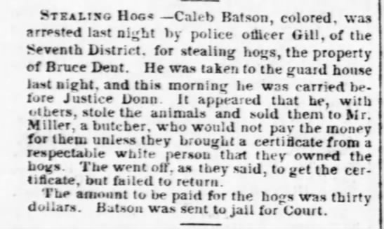
  • 1868-1869 | Arrest

    In Nov 1868, the Evening Star reports that “large crowd of colored population assembled near the Lincoln Barracks” to witness the laying of a cornerstone for “East Mission”, of Israel Methodist Episcopal Church. “There was considerable confusion and disturbance in the outskirts of the crowd during the evening confined principally to boys, and with that exception everything passed off quietly and peaceably.”

    In Dec 1868, the National Republican reports that George Dent was arrested on suspicious of participation in riot near Lincoln Barracks on Thanksgiving Day.

    In Jan 1869, the Evening Star reports that he was sentenced to three months in jail for resisting arrest. In the National Republican, it was reported that Geo Dent, Geo Poole, and Barney Clinkett were found guilty and Clinkett was sent to jail for 39 days for the riot, while Dent when away for three months for resisting arrest.

  • 1869 | Driver

    He is listed in the City Directory as a driver. He is living at the address that is consistent with Bruce Dent in the 1860s, 585 3d W.

  • 1870 | Residence in Ward 7

    George is living in the household of Silas and Fannie Greeley. Cyrus Greeley is listed in the 1871 City Directory as a cook living at 209 F SW. George is living about a block east of his father’s home on 3rd Street.
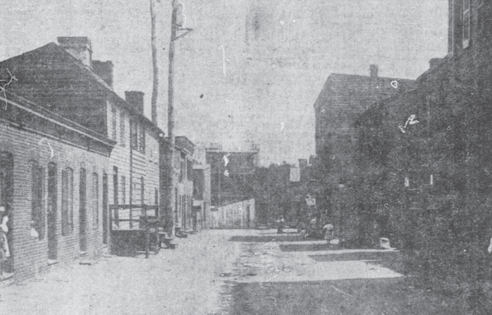
  • 1870s | Bricks

    In 1872, he is listed as a bricklayer at 513 3rd St SW. This is his father’s address, after DC updated the numbering system for addresses in 1869. In 1877, he is listed as bricklayer living in Willow Tree Alley, which is located between B and C and 3d and 4 1/2 SW.

    1910 Photograph of Willow Tree Alley as it appeared in the Washington Times | the alley was razed in 1913

  • 1874 | Affair & Arrest

    In May 1874, The Evening Start reported that Louisa Edelin, George Dent and Isabella Dent were arrested for assault and battery on John Edelin. The article reports that George Dent and Louisa Edelin (John’s wife) had been having an affair and when John found out, he addressed the trio. They assaulted him with paving stones. In Dec of 1874, George was fined $5 for his part in the assault.

  • 1878 | Arrest for Assault

    In Sept 1878, The Evening Start reported that George Dent, a hackman, was charged with assault and battery with intent to kill; he was arrested for a dispute over change from a newspaper that the boy was selling at the Baltimore and Potomac Railroad Depot. The Depot was located in Armory square, at 6th and B NW, immediately southeast of Center Market. The defense was able to show that the incident was an accident.

    Baltimore and Potomac Railroad Station | DC Public Library

  • 1879 | Profane Language and Vagrancy

    In 1879, George R. Dent was arrested twice, once for profane language, and for vagrancy for which he “was sent down to the farm.”

  • 1880 | Residence in Ward 7 of Washington City

    He is living in the household of Emma Johnson and Emma Walker, near Willow Tree Alley, on 4 and 1/2 Street. In 1882, the Critic reported that George pleaded guilty for assaulting Emma Walker and spent 7 days in jail.

    Based on the 1880 Census

  • 1884 | Soliciting fares

    In 1884, Geo. Dent was charged with soliciting hack fares in the Capitol Grounds, as reported in the National Republican.

  • 1889 | Disorderly Conduct

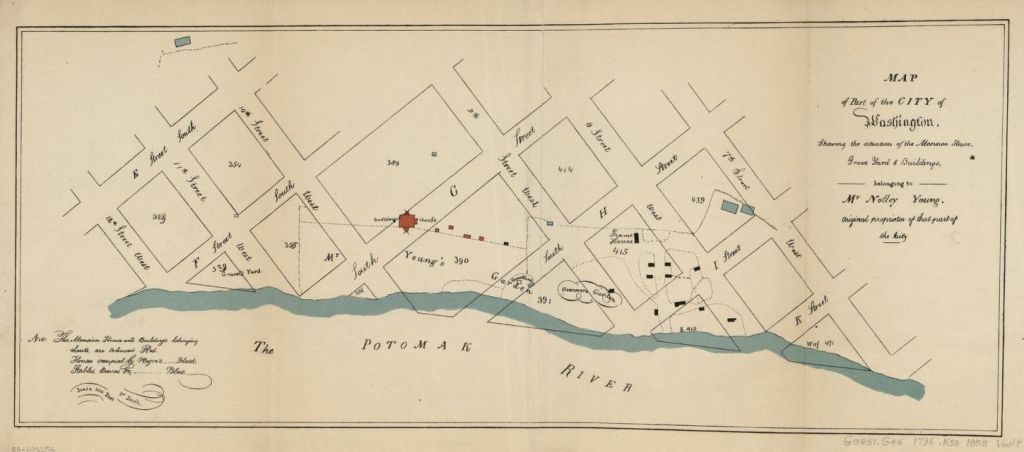
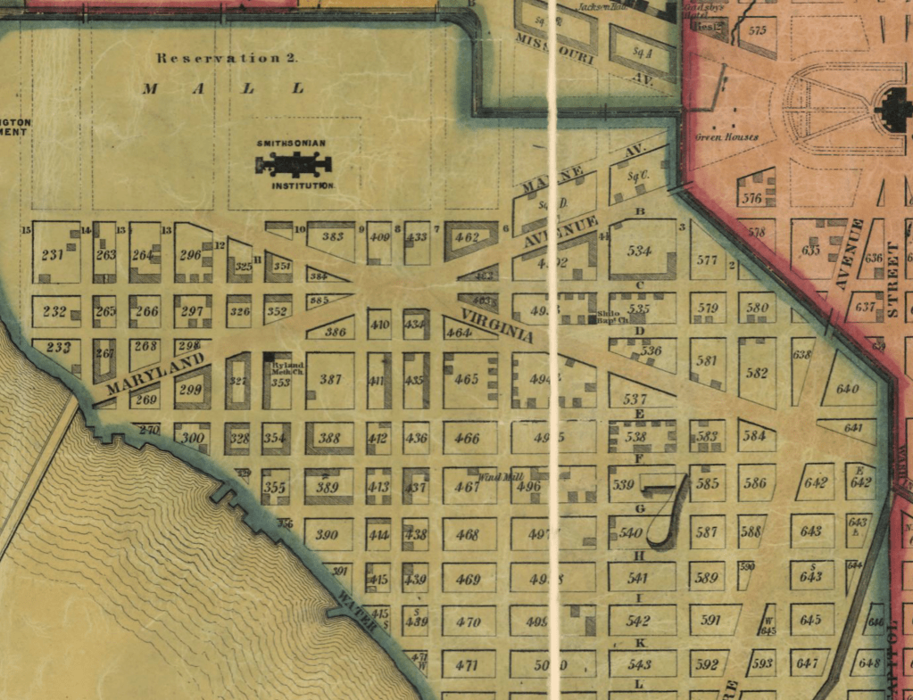
    In 1889, the Evening Star reported that “a small bald-headed” George Dent was charged with disorderly conduct at the Fisherman’s hall. The Order of Galilean Fisherman was a benevolent society established after the Civil War to help the newly emancipated Black people. It stressed equality and financial literacy. The map is an excerpt from Baist’s real estate atlas and shows square 538, where Bruce Dent held property in the 1850’s and 1860s. George lived in lots 26 of this square in the 1870. The Temple of Galillean Fisherman can be seen in the north half of square 539, off of F street.

  • 1890 | Fast driving

    In 1890, George Dent was accused of driving fast (faster than 8mph). He was a hackman who drove a Surrey and picked up fares at the Baltimore and Potomac Depot. A lawyer for Dent claimed that the animal could go that fast as he had driven him and was lame in one foot. The officer countered that the horse the lawyer had tested wasn’t the animal the Dent had driven. Dent was charged $5.

    Surrey, 1900; in the Suffolk Museum and Carriage House, Stony Brook, Long Island, N.Y. | Encyclopædia Britannica

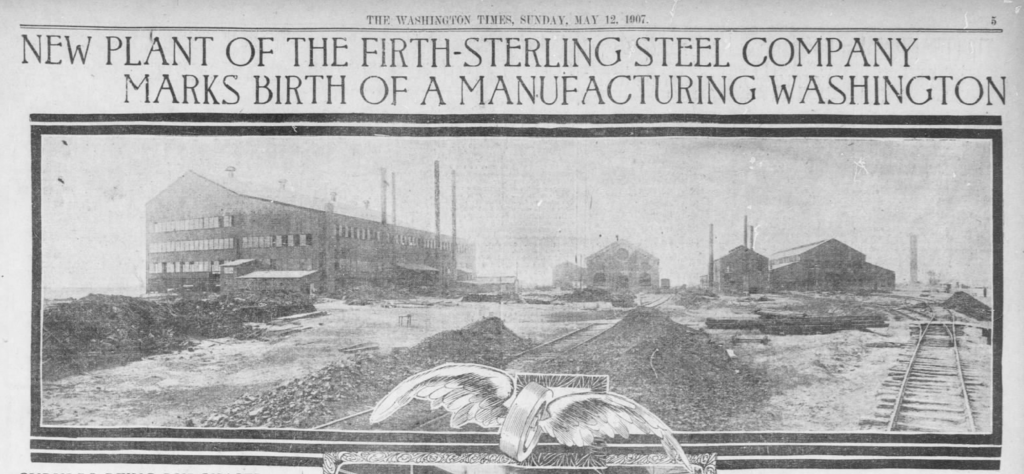
  • 1897 | Accident at Brickmaker Factory

    The Evening times reported that George Dent fell from a kiln at Ford’s brickyard. He sustained a head injury and was taken to Providence Hospital.

  • 1900 | Residence in northeast DC | Schott’s Alley

    He is living in the household of Harry Hall. His occupation is listed as a hackman and his birth month is recorded as June.

    Based on the 1900 Census

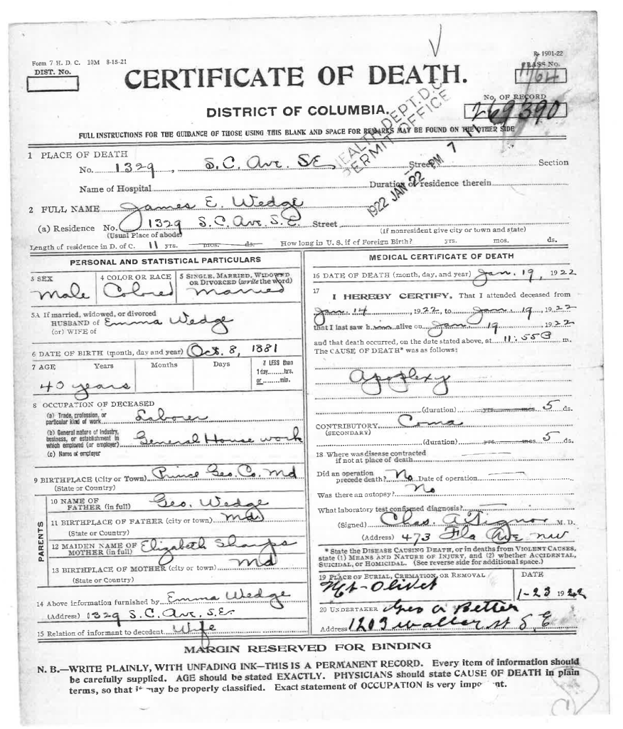
  • 1901 | Death Reported

    His death is reported in the Evening Star.

Further Research Needed:

  • Locate his death certificate from DC Archives
  • Research connections between George Dent and the names reported with him in the articles

related posts

Bruce Dent | Nonesuch property

Known Information

Bruce Dent owned property in DC during the 1850s and 1860s. He is listed as living “East of Seventh Street” in the 1870 Census.

Sources

1870 Census

1870; Census Place: East of Seventh Street, Washington, District of Columbia; Roll: M593_127; Page: 726B

Map

Map of the District of Columbia including the cities of Washington, Georgetown, and Alexandria, Virginia. [Washington?: s.n, 1873] Map. https://www.loc.gov/item/88693472/.

A complete set of surveys and plats of properties in the city of Washington, District of Columbia, 1887, plate 44 | DC Library

Newspapers

National Republican 
Washington, District of Columbia
24 Jul 1875, Sat  •  Page 9

The Critic 
Washington, District of Columbia
19 Jan 1889, Sat  •  Page 17

Washington Times 
Washington, District of Columbia

20 Mar 1896, Fri  •  Page 3

Secondary Sources

Rural Remnants of Washington County: An Architectural Survey of Washington’s Historic Farms and Estates | DC Planning Commission

Anacostia Neighborhood Museum., & Hutchinson, L. D. (1977). Anacostia Story: 1608-1930. Washington: Smithsonian Institution Press.

East of the River: Continuity and Change by Portia James

Bruce Dent is listed as a farmer in the 1870 census; he is listed in the district “East of Seventh Street”, encompassing the large agricultural tracts beyond the city boundary. In the map, this district is reflected by the First District and eastern part of Second District. Seventh Street can be identified by the subdivision of Mt. Pleasant and Howard University.

Bruce Dent is listed in the National Republican for delinquent taxes for 5 acres of property in Nonesuch in 1875 (24 Jul 1875, p 9). His property borders I. M. Young’s property as well as the Trimble Tract.

Nonesuch

George Washington Young, the grandson of Notley Young, owned property across the Eastern Banch. He owned both Giesborough Manor and Nonesuch prior to the war. He inherited Nonesuch (both the mansion and the estate) in 1826 and purchased the Giesborough tract in 1833. The Nonesuch estate was along the Oxon Run watershed. Young had a house built for his daughter Mary upon her marriage to Col. Denman.

Hopkins, Griffith Morgan, Jr. Atlas of fifteen miles around Washington, including the County of Prince George, Maryland. Philadelphia: G.M. Hopkins, 1878.

The residence of both Young and Denmead can be seen on the southern part of this excerpt from Plate 77 of the Hopkins Map. It is along Bowen Road. Bruce Dent is also labeled along Bowen Road, his name on the right side of the road.

This corresponds with City Directories that lists him as living on Bowen Road, which was named for Sayles Jenk Bowen, elected mayor in 1868 and a staunch supporter of civil rights for Black people.

The excerpt from the 1887 Plat Book shows the size and relative location of the property along Bowen Road. In 1889, the Critic lists properties with assessed taxes, and includes his property, identifying it as plat 24, Nonsuch. (19 Jan 1889, page 17)

In 1896, The Washington Times reported that Bruce transferred 2 acres of the land to Benjamin Boyd.

Further Research Needed:

  • Locate the land records in the DC Archives
  • Identify Bruce Dent’s relationship to Benjamin Boyd

related posts

Bruce Dent | the Island property

Known Information

Bruce Dent is listed in the 1860 census with real estate valued at $750; he was a huckster who sold produce in the market.

Sources

Map

Tanner, Henry Schenck, and S. Augustus Mitchell. City of Washington. [Philadelphia: S. Augustus Mitchell, 1846] Map. https://www.loc.gov/item/88694050/

Keily, James, and Lloyd Van Derveer. Map of the city of Washington D.C.: established as the permanent seat of the government of the U.S. of Am. Camden, N.J.: Lloyd Van Derveer, 1851. Map. https://www.loc.gov/item/88694049/.

Tax Assessments

Appendix 3, p. 162 of Brown, L. W. (1972). Free negroes in the district of Columbia 1790-1846. New York U.P.

City Directory

Washington, District of Columbia, City Directory, 1864

The Island

Southwest DC was called the Island as a result of the Tiber Creek and James Canal which effectively cut it off from the rest of the City. Most of the land in southwest DC had been part of Notley Young’s plantation, which had been donated to the government for the city. James Greenleaf, a real estate speculator, purchased the land from the government in return for a promise to build ten new homes a year. He was unable to deliver that promise as he was unable to secure funds. The land, cut off by the canal, was slow to develop in the 1800s. It contained old plantations, industrial facilities and assortment of workmen’s homes. The southern most point was called Greenleaf Point.

King, N. Map of part of the city of Washington, shewing the situation of the mansion house, grave yard & buildings, belonging to Mr. Notley Young: original proprietor of that part of the city. [Washington, D.C.?: s.n., ?, 1796] Map. https://www.loc.gov/item/88693256/.

In 1845, Bruce Dent was listed in the District of Columbia Tax Records. He was assessed for property in square 499 at $1.50. The 1850 census listed his real estate valued $246

Square 499 was along 4 1/2 Street which was a thoroughfare through The Island. The map excerpt from 1851 shows how few improvements had been made to the lots in that part of DC, as more of the buildings and properties had been built closer to the Mall and near the wharves and Long Bridge. This suggests that the property in Square 499 had space that allowed for growing produce and/or raising livestock. the 1888 Sanborn Map of DC shows that the alley was named Cow Alley, recalling when livestock were kept here, perhaps.

Evening Star, 01 Oct 1857, p. 3

Bruce Dent first appears in the City Directories in 1858. His address is listed as 585 3rd West. He is listed at this address through the 1850s and 1860s until 1869. This is address corresponds to square 538. It is also along 4 1/2 street.

In 1867, Bruce Dent was listed among the delinquent tax assessments in the Evening Star (14 May 1867, p. 8). It lists three properties: square 538, lot 26 and improvements; square 582, part of lot 19 and improvements, as well as part of lot 20 and improvements. Square 538 from Baist’s Real Estate Atlas is included, showing lot 26 on the 3rd street side of the block about midpoint between E and F street.

Baist, G. Wm, Wm. E Baist, and H. V Baist. Baist’s real estate atlas of surveys of Washington, District of Columbia: complete in four volumes
. Philadelphia: G.W. Baist, -<1911 >, 1909. Map. https://www.loc.gov/item/87675120/. Plate 6

Further Research Needed:

  • Locate land records at the DC Archives for deed related to square 499, square 538, and square 582
  • Identify Bruce Dent’s residence after 1870

related posts

Bruce Dent | huckster

Known Information

Bruce Dent was listed as a huckster on the 1860 Census.

Sources

Quote about Market

Washington Times, 26 Mar 1922, p 16

Tax Assessments

The National Archives and Records Administration; Washington, D.C.; Internal Revenue Assessment Lists for the District of Columbia, 1862-1866

City Directory

Washington, District of Columbia, City Directory, 1864

The Seventh Street Market. United States Washington D.C, None. [Photographed between 1861 and 1865, printed between 1880 and 1889] Photograph. https://www.loc.gov/item/2013651861/

Although the canal which ran in front of the market was sluggish and unsightly in many respects, … Sailboats and small rowboats were constantly coming to the market bringing men and shining masses of fish. These fish had often been caught during the night and brought to the market at the dawn of the day to entice the busy housewife into the purchase of the delicious Potomac Shad, trout, bass, and other fish. Men in rubber coats stood on the banks of the canal quietly smoking their old brown pipes, while others stood by their stands encouraging the purchase of vegetables, fish or other products.

Centre Market

The Centre Market was located north of the Mall, where the National Archives now stand. Located off of Pennsylvania Avenue, halfway between the Capitol and the White House, near the hotels and boarding houses for congressmen, the market was a bustling place on Mondays, Wednesdays, and Fridays.

It was also called the Marsh Market as it was adjacent to the Tiber Creek, which the fish vendors used to store their wares in wire baskets. The market was often dirty, noisy, and flooded.

Huckster

Street vendors or “hucksters,” farmers, and market men sold fruits, vegetables, and live animals to city-dwelling Washingtonians.

Exhibit on Center Market | national archives
National Republican , 30 Dec 1867, p. 3

Tax Assessments (1862-1866) listed Bruce Dent alternatively as a retail dealer and a produce dealer. He had licenses for both Center Market and Northern Liberty Market (north of Center Market on Seventh Street). The 1864 Tax Assessment and the 1864 City Directory records stall 284 as Bruce Dent’s.

Further Research Needed:

  • Locate Dent in other censuses
  • Determine how he became free (via manumission, purchase, or descent from a free woman)

related posts

George Wedge and Mary Sharps

Over the decades through census records

Known Information

George Washington Wedge and Mary Elizabeth Sharps were married in 1872 and raised their family in and around Queen Anne’s District of Prince George’s County, Maryland

Sources

1880 Census

1880; Census Place: Marlboro, Prince George’, Maryland; Roll: 513;Page: 73B | ancestry.com

1900 Census

1900; Census Place: Queen Anne, Prince George, Maryland; Page: 3;Enumeration District: 0098 | ancestry.com

1910 Census

1910; Census Place: Election District 3, Prince George’s, Maryland; Roll: T624_567; Page: 7B | ancestry.com

1920 Census

1920; Census Place: Marlboro, Prince Georges, Maryland; Roll: T625_674;Page: 4A | ancestry.com

The table summarizes the household of George and Mary Wedge from 1880-1920. The 1890 Census was burned in a fire and generally unavailable. The individuals and their ages are recorded in the table.

Note on census locations

Marlboro District is located directly south of Queen Anne’s District within Prince George’s County.

Excerpt from Hopkins Map of 1878

Name1880
Marlboro District, PG
1900
Queen Anne, PG
1910
District 3, PG (Marlboro)
1920
Marlboro, PG
George (Washington)35606075
Lizzie2855
(10 children, 6 living)
55 (10 children, 6 living)70
Edward/Eddie J524
George W/Willie121
Martha1635
Robert15
Bennie122229
Ernest10
Mary, (grand)mother6080
John, brother2140
Mary, sister16
Berry Young, grandson13
Benjamin, grandson110
Julia, daughter in law24
Robert Asbery, lodger20
William Brice, lodger35

1880 Census | Community Context

Scanning names on either side of the 1880 census listing for George Wedge allows the identification of neighbors, which used in conjunction with landowner maps provides an approximate location for their residence.

Hopkins, Griffith Morgan, Jr. Atlas of fifteen miles around Washington, including the County of Prince George, Maryland. Philadelphia: G.M. Hopkins, 1878.

The white text on the map excerpt indicate the individual’s dwelling number and page in the 1880 Census. Mordecai Plummer and Wm. B Hill were large white landowners. Walter Harrison and John Quander were Black landowners.

Plummer owned a large tract of land called “Spring Hill” that was partitioned in 1873 with some land being given to his daughter and her husband John Bowling. Henry W. Clagett, the nephew of Plummer, is listed south of the Mount Pleasant Ferry Road.

George Wedge was on page 73B, which suggest that the family lived slightly north of the Quander and Harrison house and on the east side of the road to Florenceville.

George and his family members, as well as his neighbors are listed as laborers, while Plummer and Hill are listed as farmers. In 1875, John Henry Quander purchased an acre from Clagett and worked a tenant farmer for John Bowling according to the Maryland Historical Trust Maryland Inventory of Historic Properties Form for his home. This suggests that George Wedge and his neighbors worked on the Plummer, Bowling, and Clagett properties, as well, as tenant farmers after the Civil War.

1910 Community Context

In 1910, George Wedge is listed on page 7b as John W Wedge. His wife, Lizzie, and son, Benjamin, are consistent with previous records, as is his middle initial, suggesting it was an error on the part of the census enumerator, recording John instead of George.

Their two neighbors, James Ireland and Benjamin Galloway, have the phrase “club house” listed in the notes about their occupation and in the margin of the Census page is written, “Marlborough Hills Landing Road”. This is the road on the east side Upper Marlborough that leads from Chas. Ridgeley past Wm. B Hill’s residence to a store and Boat Landing on the 1878 Hopkins Map.

The club house most likely refers to the Marlboro Hunt Club, which began in 1880. It operated as a sportsman’s club, with president’s like FDR and Teddy Roosevelt visiting. It was called the Patuxent Gun and Rod Club in the early 1900s.

Baltimore Sun, 15 Mar 1899, p. 3

On the preceding page is the record for Reverdy Sasscer. According to the documentation included in the application for House at Hills Landing to be Maryland Historic Property, the Anne Brooke, the daughter of Wm Hill, conveyed the property to Sasscer in 1901. The address given is 5802 Green Landing Road, very near to the location of the Marlboro Hunt Club.

This suggests that George Wedge and his family were living in the Hill’s Landing Community, working as a tenant farmer on the lands that historically have been owned by the Hill family.

1920 Community Context

In 1920, George Wedge is listed on page 4A. In the margins of the page, the enumerator lists North Side of Marlborough to Wells Corner Road, and the locality at the top is listed as outside town limits.

“Sugar Hill” was the name of a small African-American community that lived outside of Upper Marlboro, near the railroad lines. It had been established when several African-Americans labored on the Baltimore and Potomac Railroad after the Civil War. (Approved Historic Sites and Districts Plan) On page 3B, several of the residents are laborers for the Steam Railroad, suggesting that the Wedge family lived in vicinity of the Sugar Hill neighborhood.

George Wedge is the neighbor of Robert L Hall who married the granddaughter of Mordecai Plummer. Hall’s son was a businessman at the tobacco market, also located in vicinity of Sugar Hill.

Further Research Needed:

  • Locate records that better identify possible locations in Queen Anne’s District for the 1900 census.

related posts

George and Mary Wedge | Browns, MD

Known Information

George W Wedge died on 11 October 1924 and lived near Browns, Md. Mary Elizabeth Wedge died 25 April 1925 and lived near Browns, MD

Sources

Death Certificates

Department of Health Bureau of Vital Statistics (Death Record, Counties) Prince George’s County, [MSA SE43-3797] and [MSA SE43-3828] | Maryland State Archives

Record

1920; Census Place: Marlboro, Prince Georges, Maryland; Roll: T625_674;Page: 4A | ancestry.com

Both George and Mary Wedge had the village or city of Browns listed on their death certificate as their place of residence. Browns was a small farming community northwest of Upper Marlboro in the Marlborough District of Prince George’s County. It was located at the intersection of Brown Road and Browns Station Road, north of Cabin Branch. It is also near a community called Westphalia. The area is immediately southwest of Oak Grove.

Railway Station

Inside of Chesapeake Beach Railway Time Table for 1904, Smithsonian Institution Archives, RU 007181, Box 2, Folder 9, Image Number SIA2015-002378.
| Smithsonian Archives

RU 007181, Box 2, Folder 9;

A station was build near where Brown’s store was indicated on the map when the Chesapeake Beach Railway was built shortly before the turn of the century. The railway brought tourists to Chesapeake Beach until the Great Depression when it wasn’t financially viable anymore.

Hopkins, Griffith Morgan, Jr. Atlas of fifteen miles around Washington, including the County of Prince George, Maryland. Philadelphia: G.M. Hopkins, 1878.

Farming Community

The cluster of names around Benj H Brown with the store shows the location of Browns, Maryland. Westphalia is immediately to the west where the School House and Grave Yard are indicated. Brown appears to have operated the store as evidenced by advertisements run in the local newspaper.

The Prince George’s Enquirer and Southern Maryland Advertiser, 24 Apr 1896, page 2 | newspapers.com
Washington Times, 12 Aug 1909, page 9
newspapers.com

Further Research Needed:

  • Compare this residence with residences in the censuses

related posts

James Edward Wedge | steel worker

Known Information

James Edward Wedge moved to DC shortly after the turn of the century in the early 1900s.

Sources

Draft Registration Card

U.S., World War I Draft Registration Cards, 1917-1918 | ancestry.com

Summary Statement

James Wedge registered for the draft during World War I. His birth year was listed as 1875, compared to 1881 on his death certificate.

He listed his mother, Elizabeth Wedge, as a near relative and that she lived in Marlboro, MD. He was of medium height and medium build.

His home address is consistent with the address given on his death certificate and listed in the obituary.

Giesboro Point | Steel Manufacturing

Giesboro Point is located across the Anacostia River where it joins the Potomac River. The location is now part of the Joint Base Anacostia-Bolling. The government rented the land during the Civil War, where it served as a Calvary Depot. Prior to World War I, the land was purchased by the the Firth Sterling Steel company and they established a steel plant with railroad lines to manufacture munitions. It became the Washington Steel and Ordnance in 1911 and was dissolved in 1921 after the war when demand for munitions ended.

Washington Times, 17 March 1907, pg 13 newspapers.com
Washington Times, 12 May 1907, p 44
Washington Times, 28 Apr 1917

World War I

During World War I, it employed thousands of men in the DC area to meet the need for munitions. It paid $2 a day for unskilled labor in order to hire laborers when immigration quota and the armed forces’ recruitment of men shrunk the labor pool.

Evening Star, 15 Dec 1918, p 40

Further Research Needed:

  • The document lists his mother as Elizabeth Wedge and connects James Wedge with the Wedge family in Marlboro, Prince George’s County. What other connections between the family can be established.

related posts

James Edward Wedge | death certificate

Known Information

James Wedge married Emma Lee in Prince George’s County in 1900. They had several children listed in the 1920 census.

Sources

Death Certificate

Scanned Copy received from the DC Archives

Obituary

Evening Star 
Washington, District of Columbia
21 Jan 1922, Sat  •  Page 7
| newspapers.com

Summary Statement

James E. Wedge was born on 8 Oct 1881 in Prince George’s County Maryland to Geo. Wedge and Elizabeth Sharps, both of whom were from Maryland.

He moved to DC around 1901, which would have been shortly after his marriage to Emma. They lived at 1329 South Carolina Ave, SE.

He was a laborer in General Housework which suggests a janitorial position.

He died January 19, 1922 from apoplexy, or stroke after being in a coma for 5 days.

He was buried in Mt. Olivet.

Further Research Needed:

  • Compare the birth date for James Edward with census records
  • Identify the Sharps family and Elizabeth Sharps relation to them

related posts

Wedge and Lee families | marriages

Known Information

Emma Lee and James Wedge are listed as the parents on the death certificates of Sarah Irene Snowden, Emma M Wedge, and Joseph A. Wedge

Sources

Death Certificates

District of Columbia Deaths, 1874-1961

Image Number 01805, 1421, 1199

Marriage Records

PRINCE GEORGE’S COUNTY
CIRCUIT COURT
(Marriage License Applications)
1886-1984
T757

1900 Census

1900; Census Place: Election District 1, Anne Arundel, Maryland; Page: 25

Emma M. Lee and Jas. Edward Wedge applied for a marriage license in Prince George’s County, Maryland in 1900. They married in Upper Marlboro on 27 Jun 1900. Eddie Wedge applied for the license.

Catherine Lee and Robert Wedge also applied for a marriage license in Prince George’s County in 1904. They married in Upper Marlboro on 28 Dec 1904. George Wedge applied for the license.

1900 Census

Both Robert and James are listed in the 1900 Census with their father, George Wedge in the Queen Anne’s District of Prince George’s County. The census was enumerated at the beginning of June prior to the marriage of Emma and James at the end of June.

This suggests that Robert and James are brothers and it is likely that they married sisters from a Lee family living in the vicinity.

Emma Lee | possible census records

A search for Emma Lee in both Prince George’s County and Anne Arundel County does not return a census record that is overtly consistent with what is known about Emma Lee.

A possible record is of an Emma Lee, age 24, who is living as a boarder in a household in Annapolis. Other household members include Susan Wright.

Catherine Lee | possible census records

A search for Catherine Lee in both Prince George’s County and Anne Arundel County returns a possible record in District 1 of Anne Arundel County.

Catherine Lee is living in the household of Washington and Sallie Lee. Two sisters, Rose and Louisa are also listed in the household. Emma is not present.

Emma has several children recorded in the 1920 census, including a daughter named Catherine and Rose L(ouise). The names of her daughters suggests a connection to Washington and Sallie Lee.

In a previous post, a review of Washington Lee’s census records listed his children. Among these children were a Peter, Benjamin, Susan. Emma also has children named Peter Benjamin and Susanna in the 1920 census.

The similarity in names, as well as the proximity of Washington Lee in Anne Arundel County to the Wedge family across the river in Queen Anne’s District of Prince George’s County, suggests that Washington and Sallie Lee are Emma’s parents.

Further Research Needed:

  • What other connections can be made between the Emma Lee/James Wedge household and the Washington Lee household and or Catherine Lee/Robert Wedge household?

related posts

Washington Lee and Sallie Stewart

Over the decades through census records

Known Information

Washington Lee & Sallie Stewart were married in 1870 and raised their family in and around Queen Anne’s District of Prince George’s County, Maryland

Sources

1880 Census

1880; Census Place: Marlboro, Prince George’s, Maryland; Roll: 513;Page: 75B | ancestry.com

1900 Census

1900; Census Place: Election District 1, Anne Arundel, Maryland; Page: 25 | ancestry.com

1910 Census

1910; Census Place: Election District 1, Anne Arundel, Maryland; Roll: T624_550; Page: 12A | ancestry.com

The slideshow has the records for Washington and Sallies family from 1880, 1900 and 1910. The 1890 Census was burned in a fire and generally unavailable. The individuals and their ages are recorded in the table.

Note on census locations

Marlboro District is located directly south of Queen Anne’s District within Prince George’s County.

District 1 is located in the western part of Anne Arundel County, opposite Queen Anne’s District in Prince George’s County

Excerpt from Hopkins Map of 1878

Name1880
Marlboro District, PG
1900
District 1, AA
1910
District 1, AA
Washington Lee406073
Sallie356070
12 Children Born
8 Children still living
Jane7
Susan6
Benjamin5
Sallie3
Peterinfant
Lizzie2
Catherine14
Rosa10
Louisa7
Edwardgrandson, 3

1880 Census | Community Context

Washington and his family were recorded in Marlboro District; the location of their home can be approximated by comparing the names of their neighbors with the Hopkins’ Map of 1878. They did not live very far from their 1870 home which was northwest of Oak Grove in Queen Anne’s district.

A review of the page immediately preceding and following Washington Lee’s record shows that they lived near town. There are at least three carpenters, a bricklayer, storekeeper and hotel keeper listed among the occupation.

Geo. W Brooke and Upton Brooke are listed on the next page. They can be identified on the Marlboro District detail map from Hopkin’s Atlas as being near the Oak Grove Post Office and Brick Church Station. St. Barnabas Episcopal Church was well known for its brick construction and the station on the railroad was later renamed Leeland. It is at the intersection of the modern roads Oak Grove Rd and Leeland Road.

Hopkins created an Atlas of the fifteen miles around Washington DC including the County of Prince George, Maryland in 1878, which also lists landowners.

Hopkins, Griffith Morgan, Jr. Atlas of fifteen miles around Washington, including the County of Prince George, Maryland. Philadelphia: G.M. Hopkins, 1878.

1900-1910 Community Context

In the margin of the 1910 Census is written Governor’s Bridge to Queen Anne, which suggests that the Lee family lived near the Patuxent river between Governor’s Bridge to the north and Queen Anne’s Bridge to the south.

The Paul Sharps family is a relative neighbor of the Lee family in both the 1900 and 1910 census. In 1900, Paul Sharps is listed on page 22 of the census, while the Lee family is listed on page 25. In 1910, Paul Sharps is on the same page as the Lee family.

Washington Lee is listed as the owner of the land in the 1910 Census, while Paul Sharps rents the land he is working.

The Selman family is listed on page 26. There are two Sellman families located near Governor’s Bridge on the 1878 map of District 1 of Anne Arundel. This suggests that the Lee family lived closer to Governor’s Bridge than to Queen Anne.

This area is roughly southeast of the modern day exchange of US Highways 301 and 50.

In both census records, the Parker family has numerous households in close proximity to the Lee family, prompting the research question if they are connected.

Hopkins, Griffith Morgan, Jr. Atlas of fifteen miles around Baltimore, including Anne Arundel County, Maryland. Philadelphia, 1878. Map. 

Further Research Needed:

  • What connections exist between the Parker family and the Lee family?
  • What records exist corroborate the census record that Washington Lee owned his property in 1910?
  • Where did the children live in the 1900 census?

related posts