Known Information
Bruce Dent owned property in DC during the 1850s and 1860s. He is listed as living “East of Seventh Street” in the 1870 Census.
Sources
1870 Census
1870; Census Place: East of Seventh Street, Washington, District of Columbia; Roll: M593_127; Page: 726B
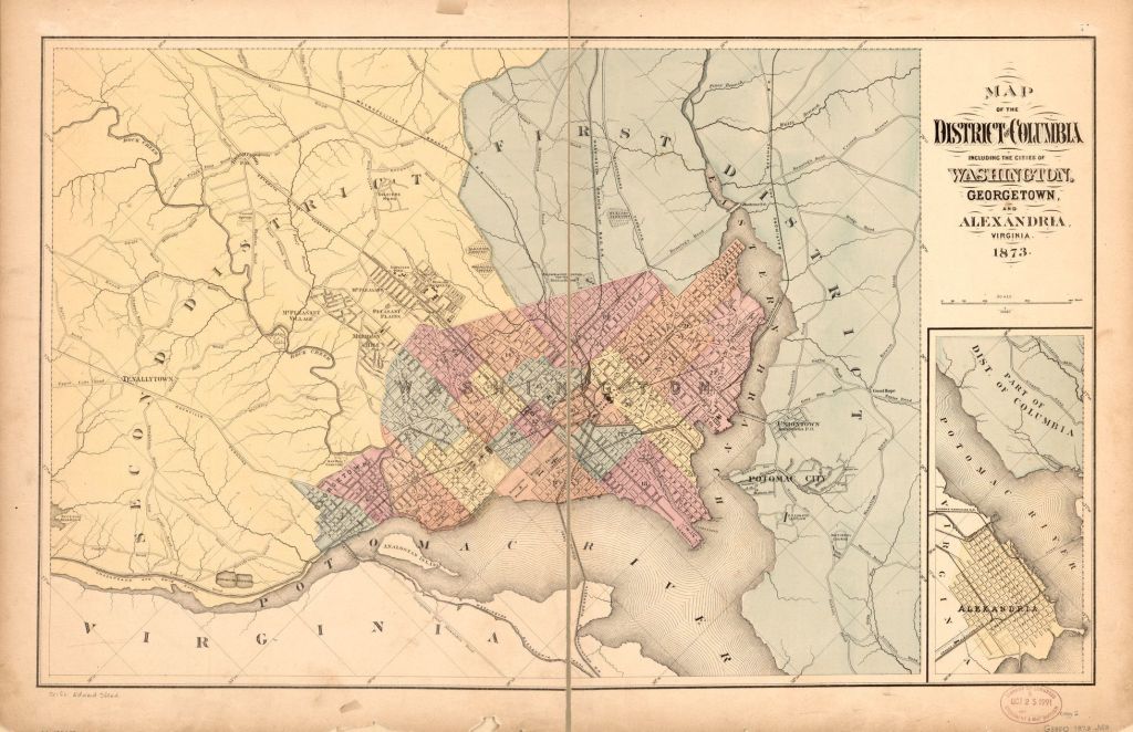
Map
Map of the District of Columbia including the cities of Washington, Georgetown, and Alexandria, Virginia. [Washington?: s.n, 1873] Map. https://www.loc.gov/item/88693472/.
Newspapers
National Republican
Washington, District of Columbia
24 Jul 1875, Sat • Page 9
The Critic
Washington, District of Columbia
19 Jan 1889, Sat • Page 17
Washington Times
Washington, District of Columbia
20 Mar 1896, Fri • Page 3
Secondary Sources
Bruce Dent is listed as a farmer in the 1870 census; he is listed in the district “East of Seventh Street”, encompassing the large agricultural tracts beyond the city boundary. In the map, this district is reflected by the First District and eastern part of Second District. Seventh Street can be identified by the subdivision of Mt. Pleasant and Howard University.
Bruce Dent is listed in the National Republican for delinquent taxes for 5 acres of property in Nonesuch in 1875 (24 Jul 1875, p 9). His property borders I. M. Young’s property as well as the Trimble Tract.
Nonesuch
George Washington Young, the grandson of Notley Young, owned property across the Eastern Banch. He owned both Giesborough Manor and Nonesuch prior to the war. He inherited Nonesuch (both the mansion and the estate) in 1826 and purchased the Giesborough tract in 1833. The Nonesuch estate was along the Oxon Run watershed. Young had a house built for his daughter Mary upon her marriage to Col. Denman.

The residence of both Young and Denmead can be seen on the southern part of this excerpt from Plate 77 of the Hopkins Map. It is along Bowen Road. Bruce Dent is also labeled along Bowen Road, his name on the right side of the road.
This corresponds with City Directories that lists him as living on Bowen Road, which was named for Sayles Jenk Bowen, elected mayor in 1868 and a staunch supporter of civil rights for Black people.
The excerpt from the 1887 Plat Book shows the size and relative location of the property along Bowen Road. In 1889, the Critic lists properties with assessed taxes, and includes his property, identifying it as plat 24, Nonsuch. (19 Jan 1889, page 17)
In 1896, The Washington Times reported that Bruce transferred 2 acres of the land to Benjamin Boyd.

Further Research Needed:
- Locate the land records in the DC Archives
- Identify Bruce Dent’s relationship to Benjamin Boyd
