Known Information
Bruce Dent is listed in the 1860 census with real estate valued at $750; he was a huckster who sold produce in the market.
Sources
Map
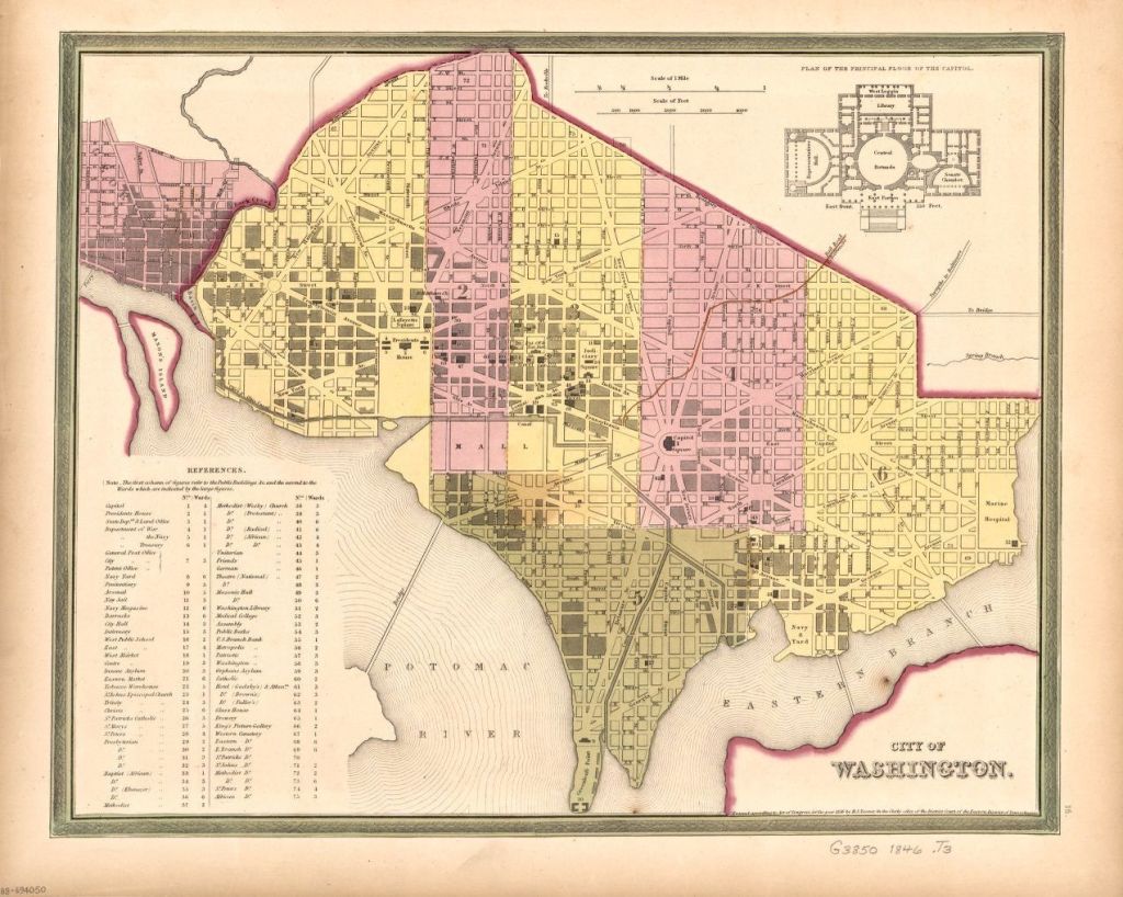
Tanner, Henry Schenck, and S. Augustus Mitchell. City of Washington. [Philadelphia: S. Augustus Mitchell, 1846] Map. https://www.loc.gov/item/88694050/
Keily, James, and Lloyd Van Derveer. Map of the city of Washington D.C.: established as the permanent seat of the government of the U.S. of Am. Camden, N.J.: Lloyd Van Derveer, 1851. Map. https://www.loc.gov/item/88694049/.
Tax Assessments
Appendix 3, p. 162 of Brown, L. W. (1972). Free negroes in the district of Columbia 1790-1846. New York U.P.
City Directory
Washington, District of Columbia, City Directory, 1864
The Island
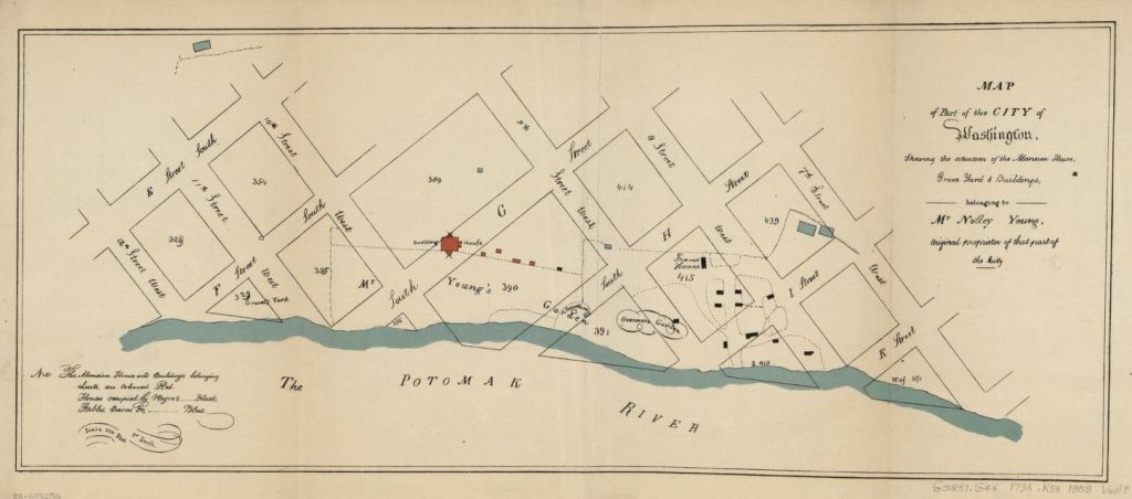
Southwest DC was called the Island as a result of the Tiber Creek and James Canal which effectively cut it off from the rest of the City. Most of the land in southwest DC had been part of Notley Young’s plantation, which had been donated to the government for the city. James Greenleaf, a real estate speculator, purchased the land from the government in return for a promise to build ten new homes a year. He was unable to deliver that promise as he was unable to secure funds. The land, cut off by the canal, was slow to develop in the 1800s. It contained old plantations, industrial facilities and assortment of workmen’s homes. The southern most point was called Greenleaf Point.
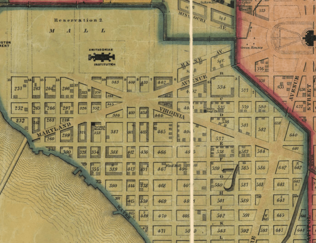
In 1845, Bruce Dent was listed in the District of Columbia Tax Records. He was assessed for property in square 499 at $1.50. The 1850 census listed his real estate valued $246
Square 499 was along 4 1/2 Street which was a thoroughfare through The Island. The map excerpt from 1851 shows how few improvements had been made to the lots in that part of DC, as more of the buildings and properties had been built closer to the Mall and near the wharves and Long Bridge. This suggests that the property in Square 499 had space that allowed for growing produce and/or raising livestock. the 1888 Sanborn Map of DC shows that the alley was named Cow Alley, recalling when livestock were kept here, perhaps.
Bruce Dent first appears in the City Directories in 1858. His address is listed as 585 3rd West. He is listed at this address through the 1850s and 1860s until 1869. This is address corresponds to square 538. It is also along 4 1/2 street.
In 1867, Bruce Dent was listed among the delinquent tax assessments in the Evening Star (14 May 1867, p. 8). It lists three properties: square 538, lot 26 and improvements; square 582, part of lot 19 and improvements, as well as part of lot 20 and improvements. Square 538 from Baist’s Real Estate Atlas is included, showing lot 26 on the 3rd street side of the block about midpoint between E and F street.

. Philadelphia: G.W. Baist, -<1911 >, 1909. Map. https://www.loc.gov/item/87675120/. Plate 6
Further Research Needed:
- Locate land records at the DC Archives for deed related to square 499, square 538, and square 582
- Identify Bruce Dent’s residence after 1870
